Prototyping new technologies: Creating new kinds of maps that explore the interconnectedness of community wellbeing

Here at Free Ice Cream we are working towards a world in which people can explore their relationships to each other and their places in ways that are more hopeful and less polarised. A world in which people can imagine plural futures and feel empowered to create change in their places.
To do this, we design playful participation tools for our digital and public spaces that help people to ask better questions and explore new possibilities of the world around them. Why playful participation? Well, as game designers we know that the best invitation to a complex conversation - such as thinking about wellbeing or the climate crisis - should be playful. The offer should be fun, or no one will do it.
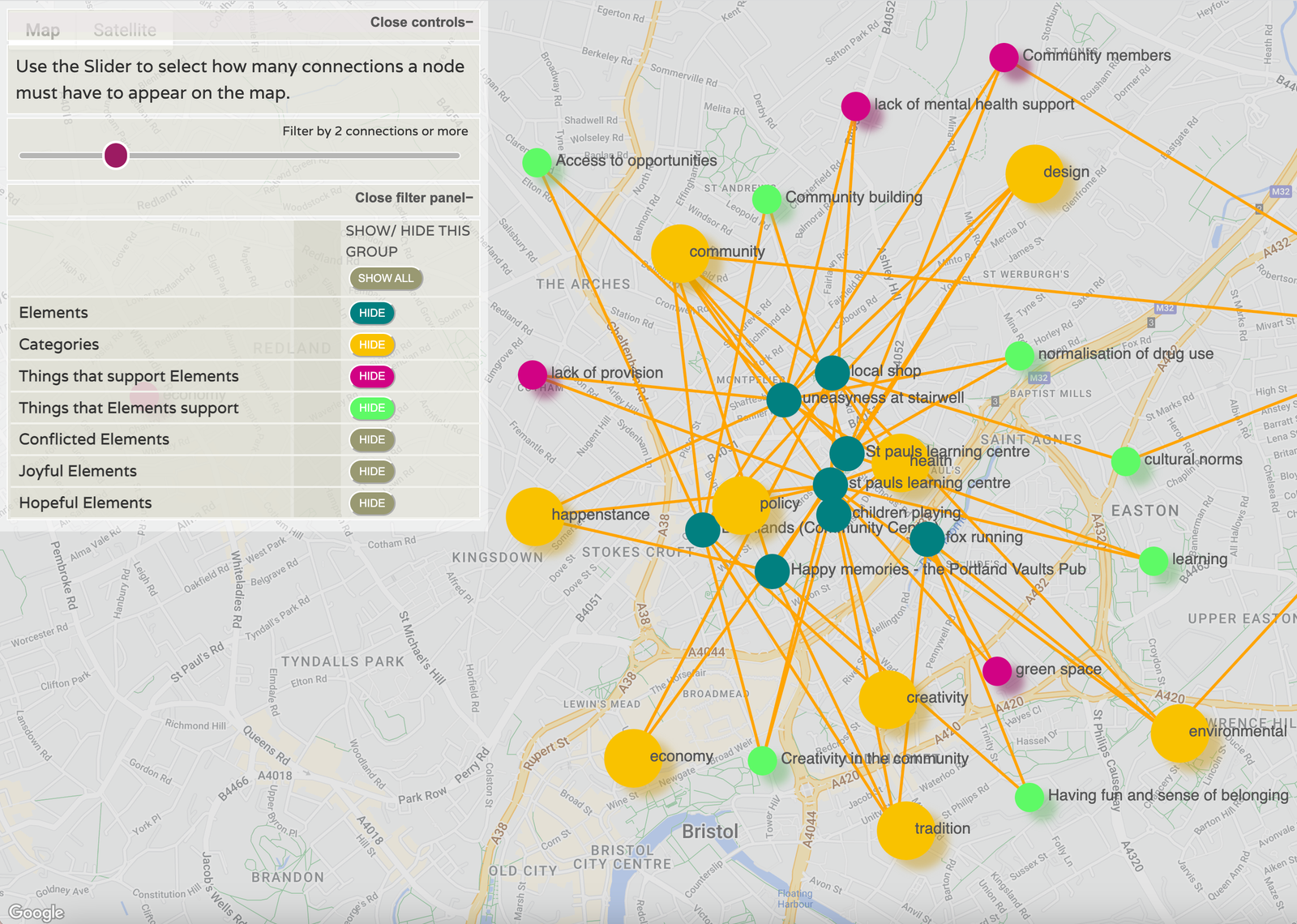
The other thing we bring to all our projects is an exploration of the interconnectedness of things, and a lot of our map work uses a node map of some form. Maps are wonderful for looking at the system that sits (often invisibly) behind people’s reality.
It’s exciting work but it’s not easy to make new technologies for social purpose - one is expensive, and the other is undervalued - so being invited to be Co-Investigator on the Public Map Platform gives us the freedom to dig into and test the best methodologies in participatory mapping with a fantastic team and enthusiastic community on Anglesey.
And as we have become more familiar with the Well-being of Future Generations Act that provides the overarching framework for the ambitions of the Public Map Platform, it’s clear that our principles and design approach are aligned with the Five Ways of Working that are already valued here in Wales (Integration, Involvement, Collaboration, Prevention, and Long Term thinking).
In essence, this just means that we don’t have to explain why we prioritise the things we do in our technologies - the PMP team and those on Anglesey just get it - which always helps when joining a new, multi-partnered team where everyone has to get used to each other and their ideas quickly enough to start effectively synthesising them.
We came to the Public Map Platform with the kernel of an idea and a basic prototype that we were calling ‘Happenings’ (it’s a working title, but it may stick) - a participatory mapping tool for exploring the built environment that prioritises a real, collective understanding of community wellbeing, rather than one that is designed to trammel time-limited citizen responses when the developers loom into view. A tool that enables communities to collectively pool their knowledge and understanding of how things relate to each other - of the interconnectedness of things. It’s been on the back burner for a long time, much to our frustration, because there is very little market imperative for creating this kind of community knowledge (let alone the tools to make change).
But wonderfully, that is exactly what the Public Map Platform is about. Finding new and engaging ways for citizens to talk about what is important to them and in a way that can inform planning and policy design at the root.
The ambition is to straddle that perspective - make something fun and engaging for communities to use, that also produces the data that can be used by the local authority in the service of better, community-informed policy and planning.
So, our work here is to build on that early idea and develop it as a mapping tool for children and young people, informed by the Well-being of Future Generations Act. We’re doing this through the lens of play - a young person’s ability (or not) to freely play or socialise in public spaces in their place. Play functions here as a kind of prism - revealing all the facets of a place and how they all support, or undermine, play. This lens (we hope) will allow us to explore social / environmental / economic / cultural wellbeing in tandem - i.e. for everyone to see these as the integrated things that they are.
Facilitated by a workshop, the tool will walk a group of young people (and those that support them) through a conversation, enabling them to talk about moments of play - or if older, simply hanging out together - through to a collective exploration of what enables or blocks them. We’ll be looking at the urban design and policy layers as enablers/blockers, but in ways that are accessible to young people.
What’s strong about this is that we deal with this very qualitative, subjective data together as a moment of collective conversation and understanding - and then the data we are left with can be analysed in the aggregate to see what the root causes are and where the levers for change are - and whether sometimes they might be the same causes or levers across quite disparate things.
We’re really excited to be bringing this kind of ecological thinking (i.e., that everything is interconnected) into a new form of community engagement. Helping communities think in systems is urgently needed as we face turbulent times. As this is new work, we’ll be updating with more details as it develops, but until then you can look at two of our other mapping platforms: